Keynote Speakers
GSCS & ICUI 2023
Biography of Keynote Speaker & Abstracts of Keynote Speeches
-
Prof. Michael BATTY
Fellow of the British Academy (FBA) and the Royal Society (FRS)
Chairman of the Centre for Advanced Spatial Analysis, Emeritus Professor of Planning, University College London, UKBiography
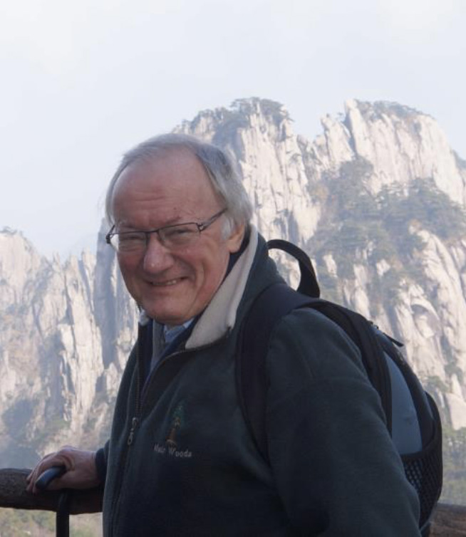
Professor Michael Batty CBE FRS FBA is Bartlett Professor of Planning at University College London. He is Chair of the Centre for Advanced Spatial Analysis (CASA) and also a Turing Fellow in the Alan Turing Institute. He has worked on computer models of cities and their visualisation since the 1970s and his recent publications Cities and Complexity (2005), The New Science of Cities (2013), and Inventing Future Cities (2018), are all published by The MIT Press. The last two of these books have been translated into Chinese. The edited book Urban Informatics (Springer 2021) reflects his focus on the applications of digital technologies to urban planning. In the 1980s, he was Professor of City Planning and Dean of the School of Environmental Design at the University of Wales at Cardiff, and prior to that a Lecturer and Reader in Geography at the University of Reading. From 1990-1995, he was Director of the National Center for Geographic Information and Analysis at the State University of New York at Buffalo. His first degree BA was in planning from the University of Manchester in 1966 and his doctorate was architecture from the University of Wales, 1984. He has published many papers and he is highly cited with an H index of 115. He is a Fellow of the British Academy (FBA) and the Royal Society (FRS). He was awarded the CBE in the Queen’s Birthday Honours List in 2004. He received the Gold Medal of the Royal Geographical Society (2015) and the Gold Medal of the Royal Town Planning Institute (2016). He has been the editor of Environment and Planning B since 1971.
Large Scale Urban Models As Digital Twins for Exploring Future Cities
Abstract
In the last decade, we have rapidly begun to build many different but related models of the same city system which we increasingly refer to as “digital twins”. We have been building single land use transportation models of large city systems for many years but only recently have we begun to scale them up to entire regions and national city systems while operating them in highly interactive environments which enable us to predict the impacts of different scenarios on the fly. With these developments, we are now in a position to develop many different versions of such models by altering their parameters and physical representations, thus spinning off “twins” of the original system, and embodying different features in their simulation. This provides us with a wide range of related tools that enable us to explore the solution space for future cities that enable us to realize a wide array of goals for future urban development. We have developed a model called QUANT for Great Britain which is organized around 8500 census zones which generate some 85002 flows for the many spatial interactions that tie key activities such as employment and population together. What we illustrate here is how the model can be used to generate different scenarios but also how variants of the model – digital twins – can help in testing different futures. We conclude by indicating how we might generate different twins by adding new modes of transport, in particular an active travel layer, to the three current modes (bus, rail and road) and how the model can be developed at a much finer scale where we divide the country into 41000 census zones, generating 410002 flows.
-
Prof. Michael GOODCHILD
Member of the US National Academy of Sciences, Fellow of the Royal Society
Professor Emeritus of Geography at the University of California, Santa Barbara, USABiography
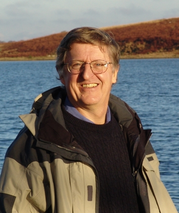
Michael F. Goodchild is Professor Emeritus of Geography at the University of California, Santa Barbara. Until 2012 he held the Jack and Laura Dangermond Chair of Geography and was Director of UCSB’s Center for Spatial Studies. He received his BA degree from Cambridge University in Physics in 1965 and his PhD in Geography from McMaster University in 1969. His research and teaching interests focus on issues in geographic information science, including uncertainty in geographic information, discrete global grids, and volunteered geographic information. He has directed or co-directed several large funded projects, including the National Center for Geographic Information and Analysis, the Alexandria Digital Library, and the Center for Spatially Integrated Social Science. He was elected member of the US National Academy of Sciences in 2002, and Foreign Member of the Royal Society and Corresponding Fellow of the British Academy in 2010; and in 2007 he received the Prix Vautrin Lud. He has published over 550 books and articles. He moved to Seattle upon retirement in 2012, and currently holds part-time positions as Research Professor at Arizona State University and as Distinguished Chair Professor at Hong Kong Polytechnic University. His full CV is at www.geog.ucsb.edu/~good.
Digital Twins for Urban Planning
Abstract
The term digital twin is becoming widely used in urban planning circles. Several reasons are suggested for its recent popularity despite the impossibility of a perfect digital twin. I review the relevance of the Turing test, and enumerate some of the ethical issues which result from the use of the term. Many open research issues will have to be addressed if digital twins are to become routinely used in urban planning and urban research.
-
Prof. Jianya GONG
Academician of the Chinese Academy of Sciences,
Professor, Wuhan University, ChinaBiography
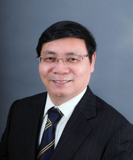
Dr. Jianya Gong is a professor of Wuhan University and an academician of Chinese Academy of Sciences. He is the winner of the National Outstanding Youth Fund, the distinguished Professor of "Changjiang Scholars" of the Ministry of Education, the chief scientist of the 973 Project, the academic leader of the Innovation Group of the National Natural Science Foundation, the leading scientific and technological talents of the State Bureau of Surveying and Mapping, and the convenor of the Surveying and Mapping Discipline Group of the sixth and Seventh Subject Review Groups of The State Council. He was the director of the State Key Laboratory of Information Engineering in Surveying, Mapping and Remote Sensing and the Dean of the school of Remote Sensing Information Engineering of Wuhan University, president of the Commission VI of the International Society of Photogrammetry and Remote Sensing, and president of International Association of Chinese Professional in Geographic Information Science. He is currently the Secretary-General of the Asian Association for Geographic Information Systems, associate editor of Acta Geodaetica et Cartographica Sinica and Editor-in-Chief of Journal of Geodesy and GeoInformation Science.
Dr. Jianya Gong is mainly engaged in the research of remote sensing and geographic information system. He has undertaken more than 40 national and provincial scientific research projects. He has published 13 monographs and textbooks, and more than 500 papers. He has won the National Science and Technology Innovation Team Award once, the first prize once and the second prize for 4 times of the National Science and Technology Progress Award, the provincial and ministerial level special prize for 3 times and the first prize for 7 times, and the Dolezal Achievement Award of the International Society of Photogrammetry and Remote Sensing.
Advances and challenges in intelligent interpretation of remote sensing
Abstract
Artificial intelligence has been rapidly developed and widely applied in many fields. Important research progress has been made in intelligent interpretation of remote sensing images, and some scenarios have been applied. However, the large-scale application of intelligent interpretation of remote sensing images is not mature enough. The report analyzes the problems existing in intelligent interpretation of remote sensing, including the small number of samples, incomplete categories, lack of standards and specifications, and the existing deep learning network framework is difficult to meet the needs of intelligent interpretation of multi-source remote sensing images. The speaker introduced his team's latest research achievements in intelligent remote sensing interpretation, including the design and research progress of LuojiaSET, a diversified and standardized sample database, and LuojiaNET, a deep learning network framework for intelligent remote sensing interpretation, as well as the typical application of deep learning in intelligent remote sensing interpretation.
-
Prof. Renzhong GUO
Academician of Chinese Academy of Engineering
Dean of Research Institute for Smart Cities, Shenzhen University, ChinaBiography

Prof. Renzhong GUO was born in Jiangsu, China. He is member of the Chinese Academy of Engineering. He received the B.S. and M.S. degrees from Wuhan University, Wuhan, China, in 1984, and the Ph.D. degree in Geography from University of Franche-Comté, Besançon, France, in 1990. He is currently a professor and the dean of the Research Institute for Smart Cities, School of Architecture and Urban Planning, Shenzhen University, Shenzhen, China.
He has been engaged in research and development of Cartography, GIS, and Construction Strategy of Digital City for a long time. Great achievements are also be made in theories and methods of Geographical Information System, Information Engineering of Land Resource Management.
The Time Perspective of Urban Research
Abstract
Under the background of the new technological revolution, urban development has shown some new characteristics, but also encountered some new problems, and smart cities have high hopes. However, ICT alone cannot solve all urban problems, so it is necessary to study new urban science and understand modern cities. This report proposes to study and understand cities from a temporal perspective.
-
Prof. Carlo RATTI
Director of MIT Senseable City Lab, Massachusetts Institute of Technology, USA
Biography
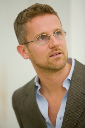
An architect and engineer by training, Professor Carlo Ratti teaches at MIT, where he directs the Senseable City Laboratory, and is a founding partner of the international design and innovation office Carlo Ratti Associati. A leading voice in the debate on new technologies’ impact on urban life, his work has been exhibited in several venues worldwide, including the Venice Biennale, New York's MoMA, London's Science Museum, Barcelona's Design Museum and Bi-City Biennale of Architecture and Urbanism. Three of his projects - the Digital Water Pavilion, the Copenhagen Wheel and Scribit - were hailed by Time Magazine as 'Best Inventions of the Year'. He has been included in Wired Magazine's 'Smart List: 50 people who will change the world'. He is currently serving as co-chair of the World Economic Forum's Global Future Council on Cities and Urbanization.
Senseable Cities
Abstract
The way we live, work, and play is very different today than it was just a few decades ago, thanks in large part to a network of connectivity that now encompasses most people on the planet. In a similar way, today we are at the beginning of a new technological revolution: the Internet is entering the physical space – the traditional domain of architecture and design – becoming an “Internet of Things” or IoT. As such, it is opening the door to a variety of applications that – in a similar way to what happened with the first wave of the Internet - can encompass many domains: from energy to mobility, from production to citizen participation. The contribution from Prof. Carlo Ratti will address these issues from a critical point of view through projects by the Senseable City Laboratory, a research initiative at the Massachusetts Institute of Technology, and the design office Carlo Ratti Associati.
-
Prof. Ying JIN
Director of the Martin Centre for Architectural and Urban Studies,
Professor of Architecture and Urbanism
University of Cambridge, UKBiography
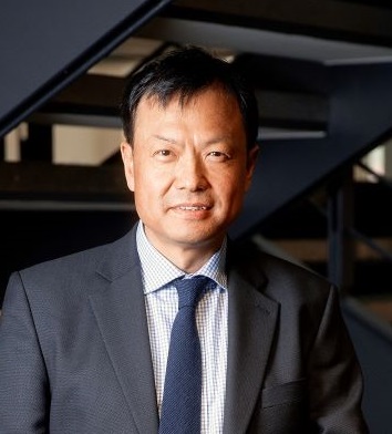
Ying Jin is Professor of Architecture and Urbanism at Department of Architecture, University of Cambridge. He is Director of the interdisciplinary Martin Centre for Architectural and Urban Studies, where he leads in the modelling of symbiotic relationships among the economy, land use, transport, urban design and the environment. He has led large modelling teams to work on complex policy and infrastructure projects, including the first land use and urban economic modelling study of the Elizabeth Line (formerly known as CrossRail) in the UK and the World Bank's regional impact assessment of China's High Speed Rail programme. He is a Fellow of Robinson College, Cambridge.
Insights from mapping the evolution in the distribution of young adults among mega-city regions
Abstract
This talk seeks to examine trends in urban growth and decline through the presence of young adults over time, particularly the young adults aged 25-34 who are at their most mobile.
The mapping and analysis are illustrated using Census data from the UK from 1961 to 2021 - this is a good quality dataset that can be used to trace the presence of young adult residents and workers over the six decades among all the constituent city regions. The results show a story of economic polarization, with a concentration of economic growth towards London and its hinterlands and persistent declines in the rest of the country. For example, in 1961, in England and Wales young adults of this age group spread fairly evenly, with a median value of 12.5% (or 1 in every 8 people) in a Census Ward. By contrast, the most recent 2021 Census shows that the share of young people are polarising at both ends: 156 Census wards have got more than 1 in every 4 people in this age band (whilst in 1961, only 3). Another 667 wards have got less than 1 in 13 people in this age band (whilst in 1961, only 70).
The UK government has always been very conscious of the concentration of economic activity towards London and the north/south divide ever since the onset of industrial and mining declines in the 1920s, having published reams of government reports and white papers on the topic. The stark contrast between the continuous policy efforts and the harsh reality of worsening polarisation highlights the need to understand and explain what has been missing in the existing policy narratives. This talk put forward a new perspective to understand and explain this phenomenon, whilst demonstrating the power of urban informatics.
-
Prof. Anthony YEH
Academician of the Chinese Academy of Sciences, Chair Professor of the Department of Urban Planning and Design,
The University of Hong Kong, Hong Kong SARBiography
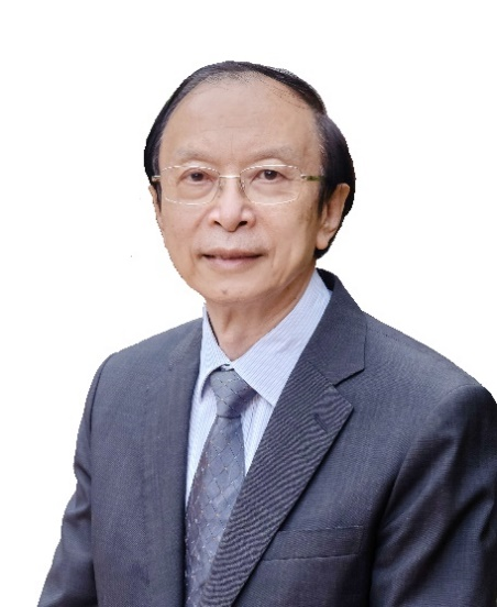
Prof. Anthony G.O. Yeh is a Member of the Chinese Academy of Sciences and Hong Kong Academy of Sciences and Fellow of TWAS (The World Academy of Sciences) and Academy of Social Sciences UK. He is Chan To-Hann Professor in Urban Planning and Design and Chair Professor of Department of Urban Planning and Design and Director of GIS Research Centre, and former Dean of Graduate School, Director of Centre of Urban Studies and Urban Planning, Institute of Transport Studies at the University of Hong Kong. His main areas of specialisation are in urban development and planning in Hong Kong, China, and South East Asia and the applications of geographic information systems (GIS) as planning support system. He received the UN-HABITAT Lecture Award in 2008 for his outstanding and sustained contribution to research, thinking and practice in the human settlements field. His projects have won a gold medal in the 2018 Geneva International Exhibition of Inventions and gold award in the 2022 Hong Kong ICT Smart Logistics Award.
He has published over 30 books and monographs and over 180 international journal papers and book chapters. He also serves as editorial board members in major international journals and honorary professors and external examiners of a number of universities and research institutes in China and S.E. Asia. He has been President of Asia GIS Association, Founding Secretary-General of the Asian Planning Schools Association and Asia GIS Association, Founding President of the Hong Kong GIS Association, Vice‑President of the Commonwealth Association of Planners, Vice‑President of the Hong Kong Institute of Planners, and Chairman of the Geographic Information Science Commission of the International Geographic Union (IGU).
Urban Big Data and Urban Planning
Abstract
The development of smart cities is a worldwide phenomenon. Smart cities have generated a lot of big data. The combination of these big data and artificial intelligence has produced many new methods and applications of data analysis and urban simulation. However, in order to use these data properly, we need to understand the issues and limitations in using them in urban planning.
Biography of the Co-chair of Panel Discussion
-
Prof. Chenghu ZHOU
Academician of the Chinese Academy of Sciences;
Professor at the Institute of Geographic Sciences and Natural Resources, Chinese Academy of Sciences (CAS), China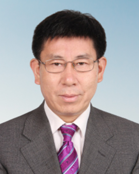
Prof. Zhou Chenghu is a professor at the Institute of Geographic Sciences and Natural Resources, Chinese Academy of Sciences (CAS), and an Academician of the Chinese Academy of Engineering. He is mainly engaged in the research of remote sensing and GIS and its connection with geoscience, including knowledge mining of spatial data, geological intelligent computing, numerical simulation analysis and evaluation of information systems of flood disaster, geological analysis and application of remote sensing images. He has established a quantitative remote sensing analysis model of geomorphic entities and a digital geomorphic mapping technology. Furthermore, he has established a global discrete geographic grid model for hydrological spatial and temporal data, developed application models such as river hydrological process simulation and risk assessment. He has published more than 300 academic papers, including more than 70 SCI papers, 19 academic monographs and atlases, and more than 7,300 citations by domestic and foreign peers. He has won 15 national and provincial science and technology awards, including 5 national science and technology progress awards and 4 provincial and ministerial science and technology awards.
Biography of the Chair of Conference Organizing Committee
-
Prof. Wenzhong SHI
Academician of International Eurasian Academy of Sciences, Fellow of Academy of Social Sciences (UK);
President of International Society for Urban Informatics
Director of Otto Poon Charitable Foundation Smart Cities Research Institute, The Hong Kong Polytechnic University, Hong Kong SAR, China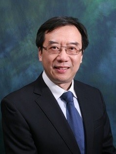
Professor Wenzhong Shi is the Director of PolyU-Shenzhen Technology and Innovation Research Institute (Futian), Director of Otto Poon Charitable Foundation Smart Cities Research Institute of PolyU, Chair Professor in Geographic Information Science and Remote Sensing, and Director of Joint Research Laboratory on Spatial Information of PolyU and Wuhan University. He is Academician of International Eurasian Academy of Sciences and Fellow of Academy of Social Sciences (UK). He earned his doctoral degree from University of Osnabruck in Vechta, Germany in 1994. He is a Fellow of Royal Institution of Chartered Surveyors and Hong Kong Institute of Surveyors, Professor Shi also serves as President of International Society for Urban Informatics and Editor-in-Chief of International Journal Urban Informatics.
His research covers urban informatics for smart cities, geographic information science and remote sensing, artificial-intelligence-based object extraction and change detection from satellite imagery, intelligent analytics and quality control for spatial big data, and mobile mapping and 3-D modelling based on LiDAR and remote sensing imagery. He has published over 300 research articles in journals indexed by Web of Science and 20 books. He is among the worldly top 2% cited researchers according to the standardized citation indicators published by Elsevier BV and scholar in Stanford University. He has obtained over 40 patents.
Professor Shi won State Natural Science Award, China's highest award for fundamental research, in 2007; Distinguished Scholar Prize by CPGIS and Smart 50 Awards in 2021; Gold Medal in 2021 & 2023 Geneva Invention Expos; Founder's Award by International Spatial Accuracy Research Association in 2020; Science and Technology Progress Award in Surveying and Mapping (Grand Award) in 2017; Wang Zhizhuo Award by International Society of Photogrammetry and Remote Sensing in 2012; and ESRI Award for Best Scientific Paper by American Society of Photogrammetry and Remote Sensing in 2006.

